Construction Survey /

Trusted by

SIMPLIFY YOUR SITE SURVEYS /

We capture images and data easily with a drone. Creating precise 2D maps and 3D models, instantly upload them to the cloud and view anywhere in the world. You can also share with all members of the construction/planning team.

SAVE TIME AND MONEY /

Get results faster than ever before. Per day, a drone crew and equipment is cheaper than a ground-based surveyor. The resulting workflows we offer increase efficiency, free up time, reduce risks and ultimately increase profits for your business.

GREATER PERFORMANCE MONITORING /

Your data is available faster, and can be shared immediately with project stakeholders anywhere in the world for better communication and collaboration. Our flight paths are saved, meaning we can complete the flights multiple times and replicate data sets to observe changes over times.

OUR SOLUTIONS PROVIDE INSIGHT BEFORE YOU EVEN GO INTO THE GROUND

Whether supporting a planning application or creating topographical maps of land prior to development, an aerial survey provides a new perspective, providing spatial layout and unrivalled insight into landscape conditions. Our UAV Drones can cover a much larger area of ground per day than traditional surveying methods on foot.

The resulting dataset of imagery and 3D data can be used to build out topographical maps, cut and fill plans and photorealistic 3D models of existing existing buildings. This data can be exported and easily integrated into architects’ existing workflows – GIS programs or CAD software such as the Autodesk suite.

An example of data from a construction survey on a computer screen

If you have got this far there is a fair chance you may be thinking of ways for drones to enhance your operation.....

Get in touch with our team today to see how we can work together.

ONE OFF BESPOKE tasks OR REPETITIVE flights FOR PROJECT MANAGEMENT TEAMS

Skylens offer a range of options to suit your business needs and we pledge to harness our teams extensive knowledge to create the perfect drone survey solution for you.

Once your requirements have been established our teams will arrive on site, collect the data while causing zero disruption to the site, process the data and deliver the results to the requested stakeholders. These stakeholders commonly include – Site Managers, Quantity Surveyors, Groundworks Contractors, Construction & Technical Directors.  We can provide solutions to ensure the data can be accessed from any device anywhere in the world.


Volumetric analysis of different piles of earth at a construction site

Multiple Outputs

We can provide you a variety of different outputs depending on what the task is. This ranges from super high quality stills and video content through to 3d models, Orthomosaic Maps, Digital Terrain Models (DTM), Digital Surface Models (DSM). Our team will work out with you if you want us to process the data and provide you reports and integrated solutions to view the data. We are able to export the 3d data to work within your exist BIM systems and existing systems. Our support team are also happy to just provide the raw data for your internal teams to process.

OUR EQUIPMENT

We have a range of high tech UAV and sensor equipment to get the job done. Our flagship UAV the DJI Matrice 300 RTK is unmatched in its safety features, technology and versatility being able to carry multiple sensors. The connection to an RTK Base station allows us to gather MM accurate results and helps the platform hold position even in the harshest f environments. This drone has as a minimum a double redundancy on all of its critical flight elements and can even maintain flight on 3 propellers. We are able to operate at night, heavy wind and even in the rain making it an ideal response tool in those emergency situations.

Click below to find out more about this system and others that we use.

DJI H20T /

Multi-sensor payload combining a wide camera, 200x zoom camera, Radiometric Thermal camera & Laser Range Finder. The most versatile UAV sensor to date for commercial inspections.

DJI P1 /

A 45 MP full frame photogrammetry and 3d modelling weapon. Boasting a new super fast global mechanical shutter it allows us to snap images every 0.7 seconds even on the move.

Z15 Spotlight /

A 10,200 lumen LED spotlight that matches the movement of the primary camera sensor allowing us to capture clear RGB inspection imagery at night.

DJI L1 /

A Livox Lidar module, a high-accuracy IMU, and a RGB camera with a 1-inch CMOS sensor. The L1 forms a complete lidar solution efficiently capturing complex structures and landscapes.

ANALYZE AND MITIGATE RISKS WITHOUT HAVING TO WALK EACH JOB SITE

**** Reduce exposure to potential harmful environments for ground surveyors.**** **** Our drone operators fly from a position of safety away from moving machinery and hazardous materials, making life easy for site managers and health and safety executives.****

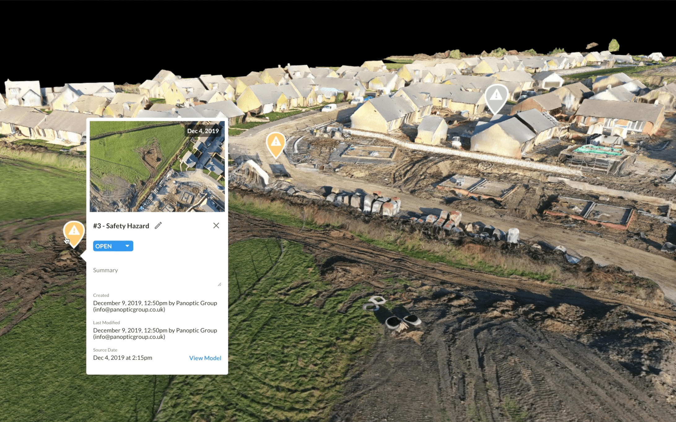
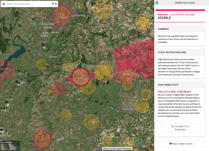
SAFETY & FLIGHT PLANNING

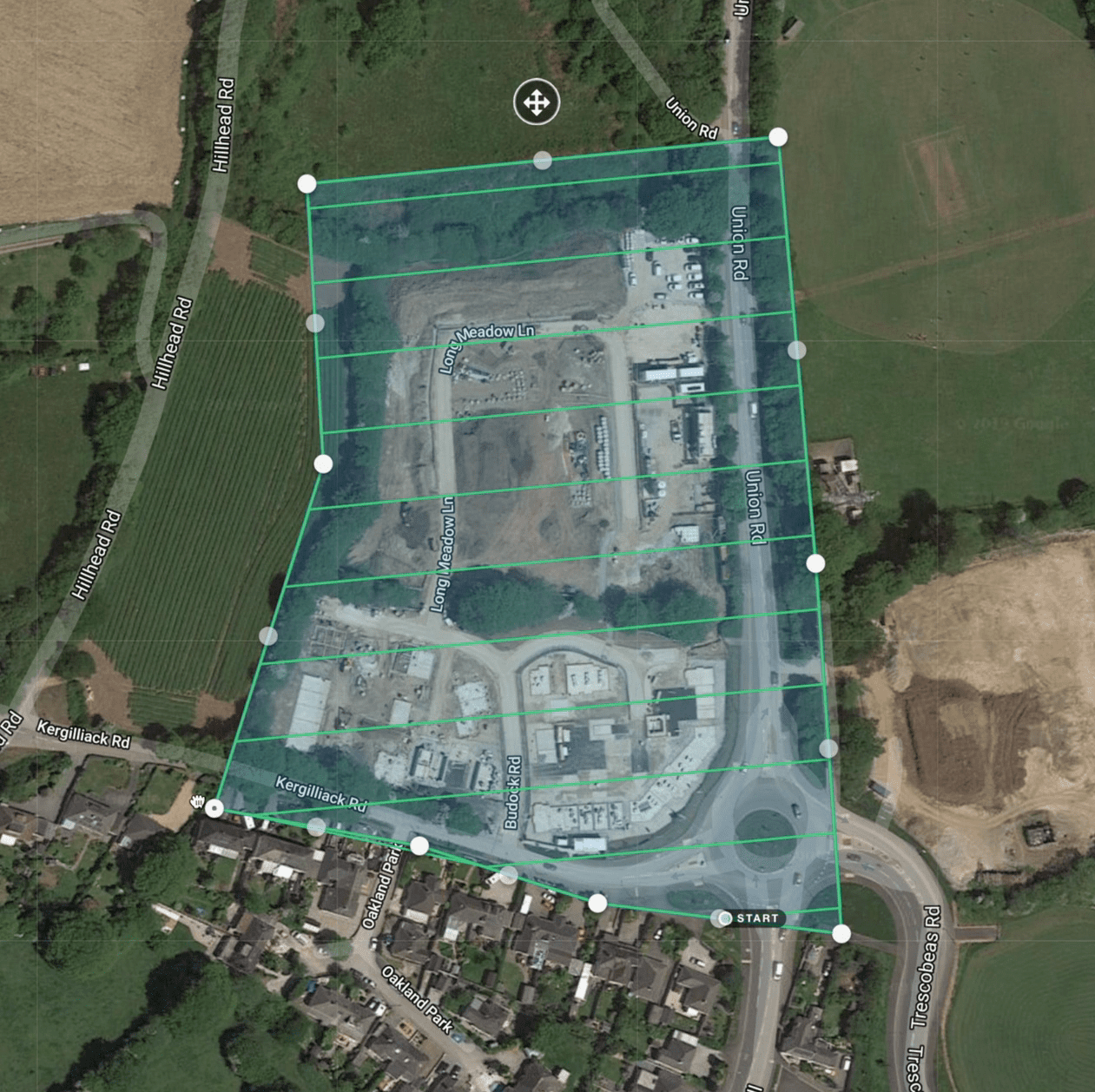
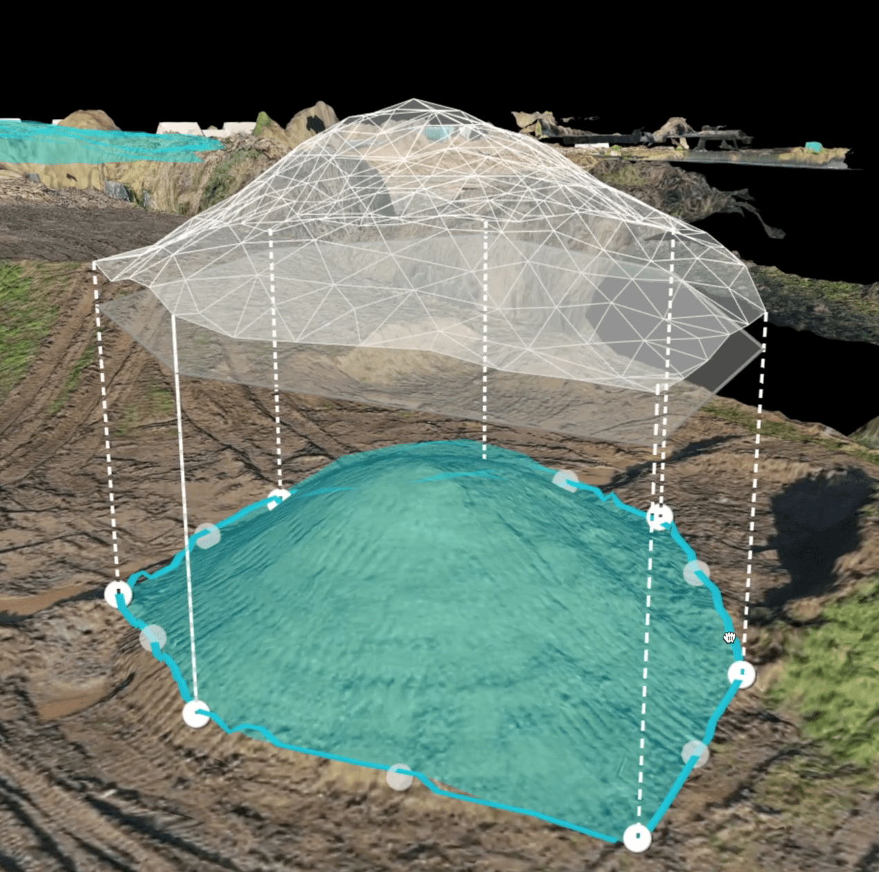
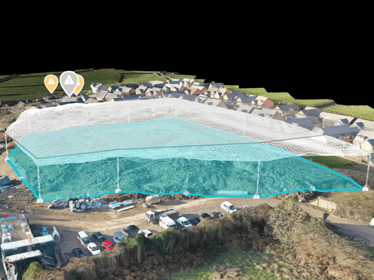
Safety and planning is paramount across our projects, each task is individually analysed, vigorously Risk Assessed (RAMS) and meticulously planned  by our team of highly qualified and knowledgeable UAV Drone pilots and support team. We have built our own state of the art Ai flight planning system to ensure full compliance.

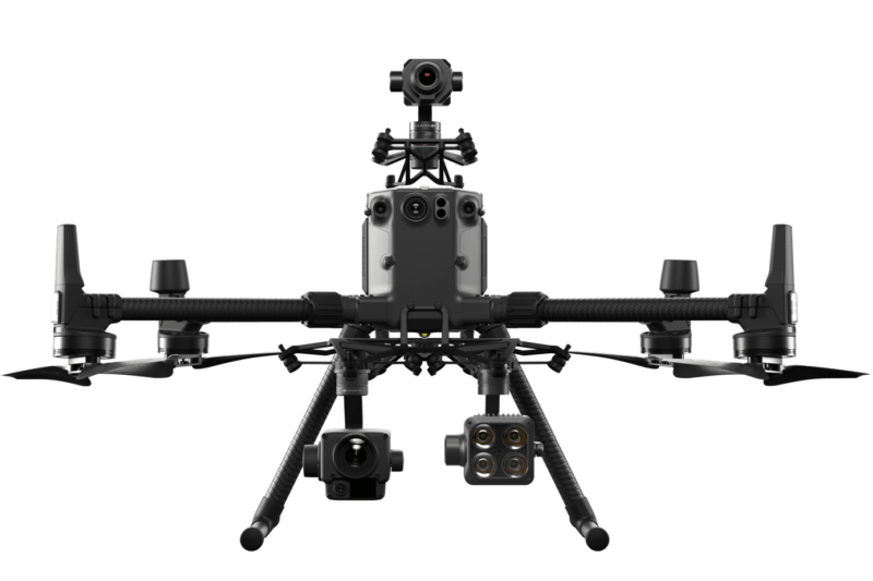
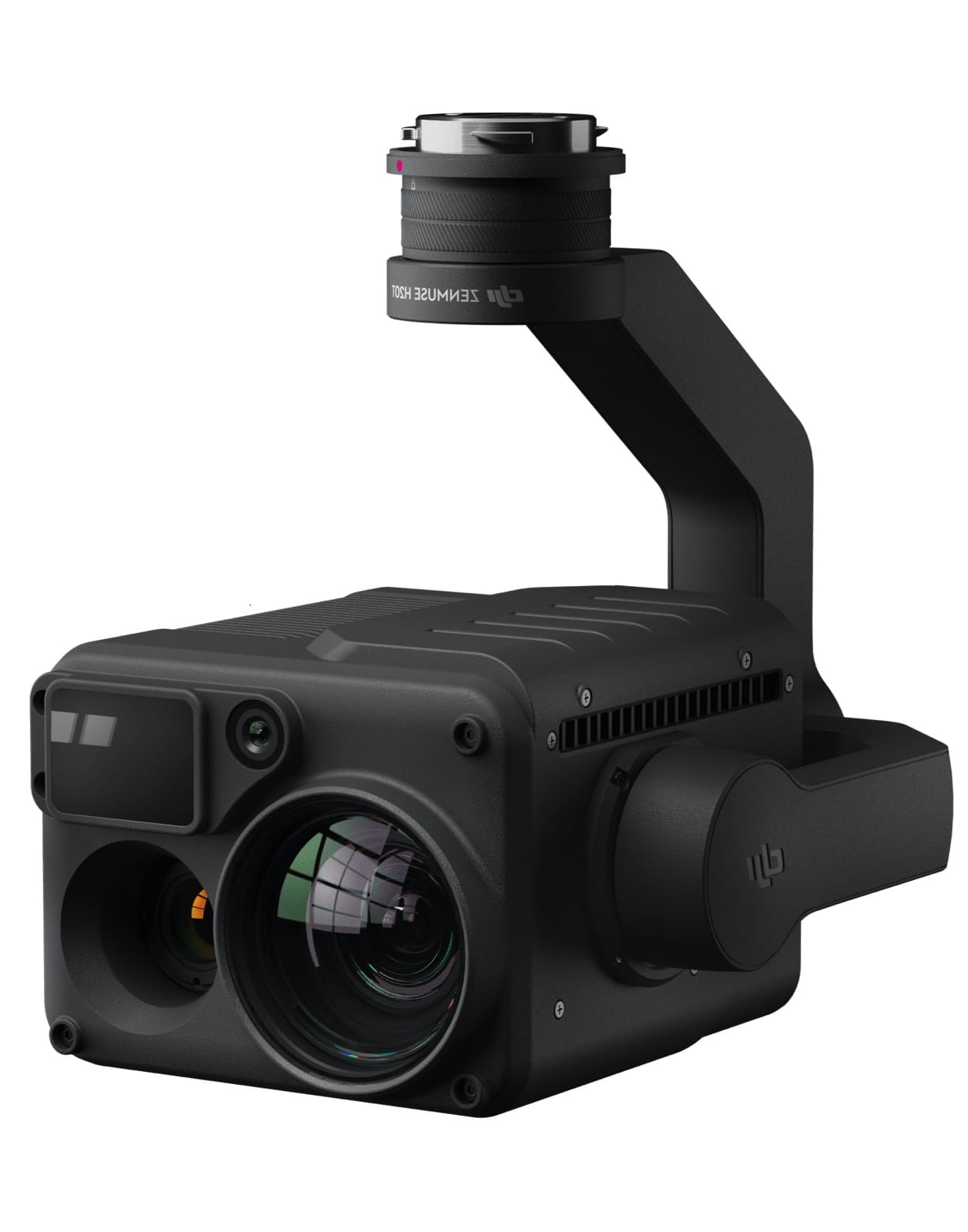
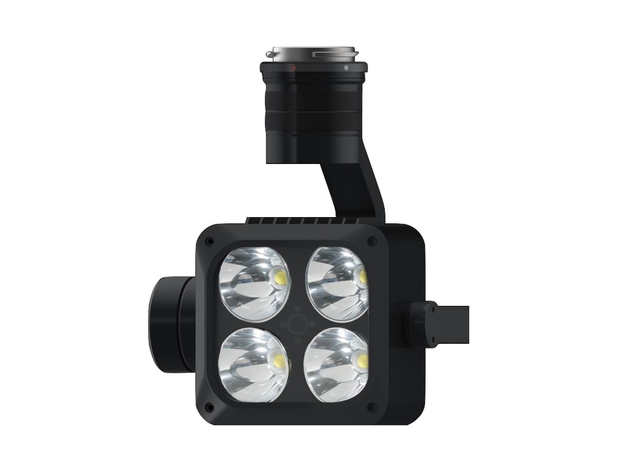
The Skylens fleet of high tech UAV systems boast extensive safety features such as Parachute systems, Advanced optical vision sensors, Aircraft strobes, Flight System redundancies and ADSB aircraft positional broadcast systems allowing us to monitor airspace for other conflicting air traffic.

Our UAV Drone survey and inspection services are conducted in accordance with our permission for commercial operations (PFCO) issued by the CAA (Civil Aviation Authority). We hold specialist public liability insurance to the value of £10 Million.

Aerial map of flight restriction zones