Equipment /

Old Problems - High Tech Solutions

The team here are big believers in the old saying “You need the right tools for the job”. We like to be efficient and produce quality results – because of this we have invested heavily to acquire the best kit in the business, meaning we are rarely matched when it come to the UAV and support equipment available to us. Half the battle is often the logistics of getting our teams into the optimal place to carry out the work. This often means working from our specialist Rib on the open water or can be found tackling rivers and moorland in our capable Landrover Discovery support vehicle. Below is a little more detail on the equipment we have at our disposal.

A UAV

Support Vehicles

Landrover Discovery 3.0 v6

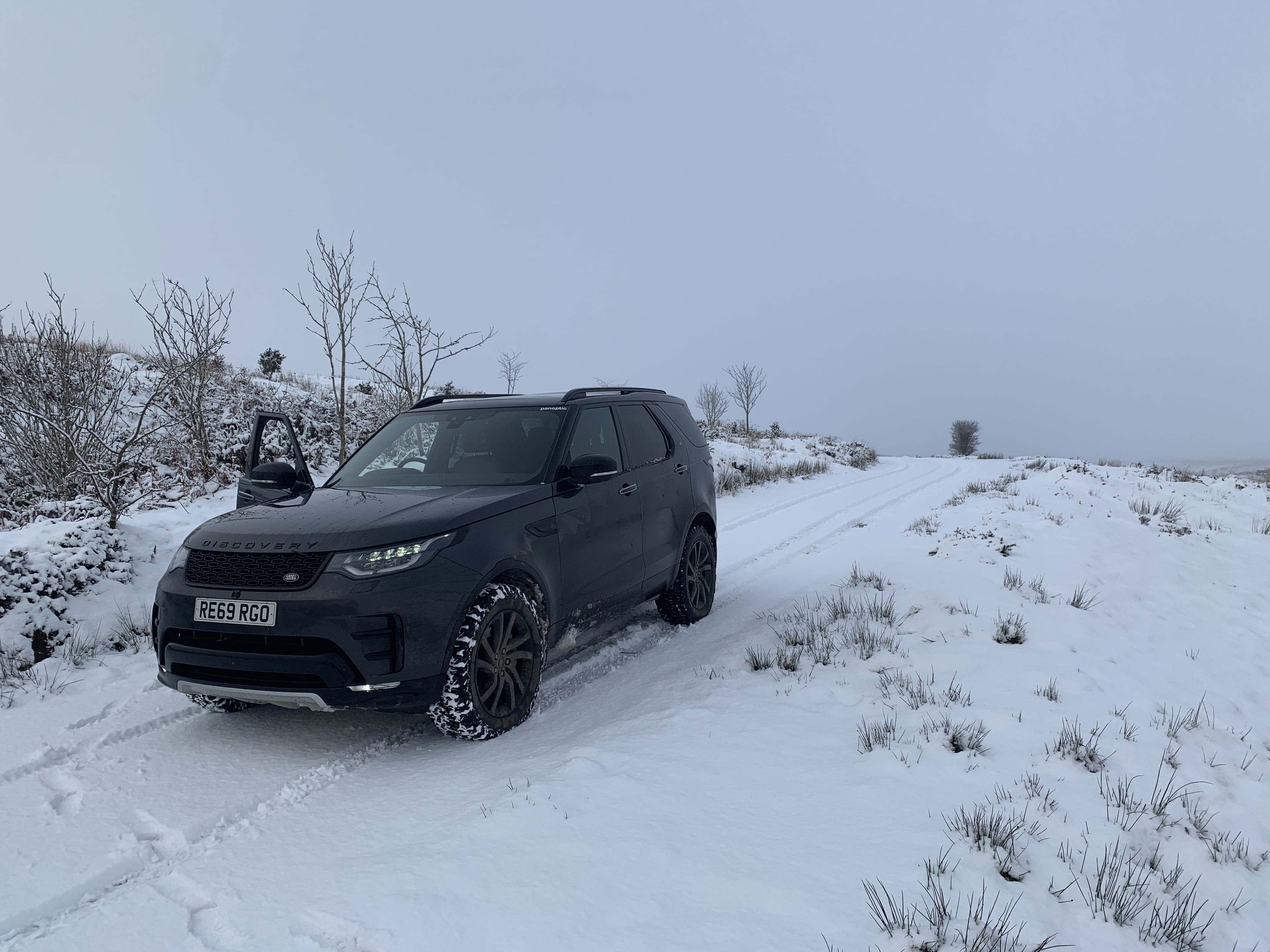
We often find that getting to a destination is one half of the battle. A battle that we win hands down every single time! Having the ability to drive easily off-road, cross streams and explore off the beaten track allows us to travel to those hard to reach places without a sweat.

Whether it be inspecting a storm damaged electricity pylon in a remote area or documenting coastal erosion on a sandy stretch of beach, our 4 x 4 Landrover Discovery will have no issue in getting us into position to launch our drone and ground station equipment to complete a safe and detailed flight.

We also have access to multiple off road support vehicles such as gators and quads.

With the nature of surveying the great outdoors a lot of the agricultural work will be taken place on dense moorland, marshes or farmed grassland. If you cant get into the correct position to launch the drone, it’s not only unsafe to do so but the precision and the results of the flight will be effected if the drone team cant get into position without the use of the off-road support vehicle.

Wherever the job, we can get there!

Two men in the foreground look at a Land Rover Discovery in the distance

Offshore RIB & Jetski

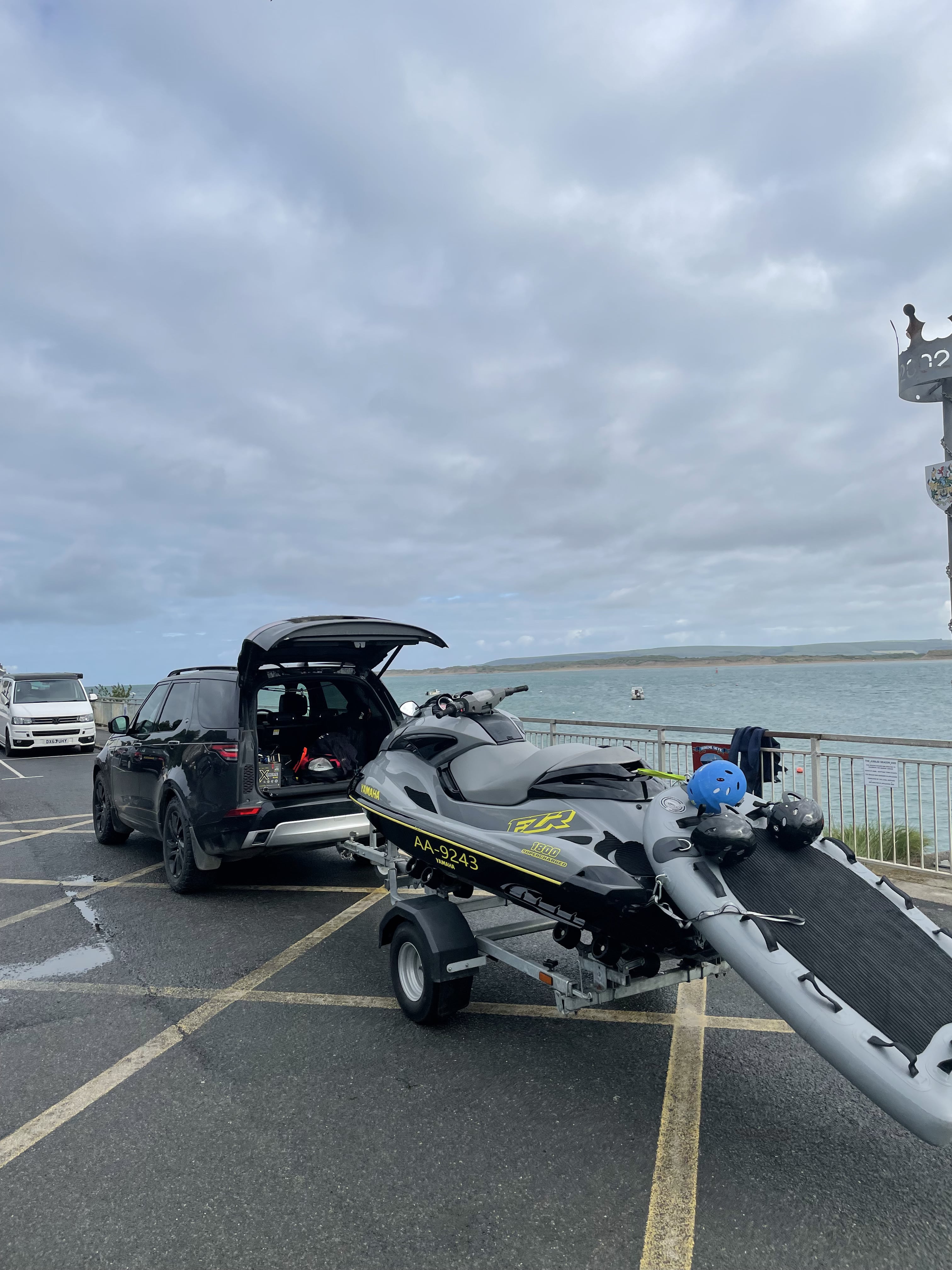
With the land covered for all situations we don’t just stop there! We have the very special ability to cover both land and water with our Offshore Humber RIB and Jetski set ups. There really isn’t a job that we cant tackle, having adapted and transformed our offshore RIB into a portable drone take off station, we can easily launch our specialist drones from anywhere at sea or in large bodies of water.

Offshore wind turbines, oil rigs, large vessels and coastal erosion can all be monitored with ease, having our boat right there in the thick of the action not only means we can collect the data instantly, but offloading and seeing the results immediately is a huge advantage. The days of waiting to return to the office miles away and transferring data are in the past for us! Our clients no longer have to wait days or even weeks before seeing the results from those hard to reach places.

A Land Rover Discovery attached to a trailer carrying an off-shore rib

Heavy Lift UAV

DJI Matrice 300 RTK

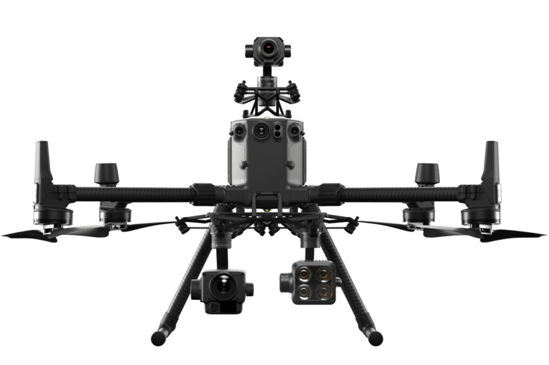
We have a range of high tech UAV and sensor equipment to get the job done. Our flagship UAV the DJI Matrice 300 RTK is unmatched in its safety features, technology and versatility being able to carry multiple sensors. The connection to an RTK Base station allows us to gather MM accurate results and helps the platform hold position even in the harshest of environments. This drone has as a minimum double redundancy on all of its critical flight systems and can even maintain flight on 3 propellers. The M300 is IP45 rated meaning we are able to operate at night, heavy wind and rain making it an ideal response tool in those emergency situations.

The platform allows us to utilise multiple sensors and we have the following at our disposal.

DJI H20T /

Multi-sensor payload combining a wide camera, 200x zoom camera, Radiometric Thermal camera & Laser Range Finder. The most versatile UAV sensor to date for commercial inspections.

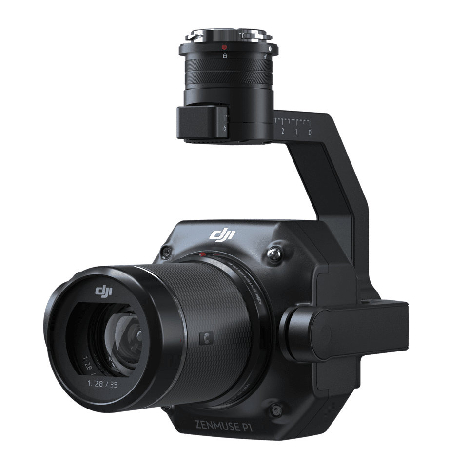
DJI P1 /

A 45 MP full frame photogrammetry and 3d modelling weapon. Boasting a new super fast global mechanical shutter it allows us to snap images every 0.7 seconds even on the move.

Z15 Spotlight /

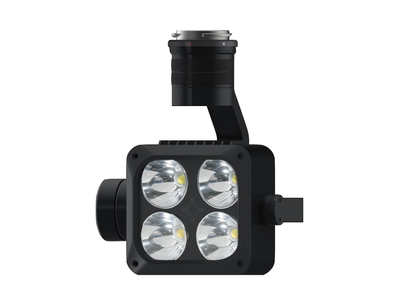
A 10,200 lumen LED spotlight that matches the movement of the primary camera sensor that allows us to capture clear RGB inspection imagery at night or low light situations.

DJI L1 /

A Livox Lidar module, a high-accuracy IMU, and a RGB camera with a 1-inch CMOS sensor. The L1 forms a complete lidar solution efficiently capturing complex structures and landscapes.

Lightweight UAV Platforms

DJI Mavic 2 Enterprise Series

Small but mighty… Don’t let their size put you off. Weighing in at just under 1kg these make the ideal solution where speed and size matter. If you need to get up above a congested area – no problem as we can use parachute systems to reduce the kinetic energy of any potential failure. That sounds a bit doom and gloom and touch wood we have never needed it. This series of drones are also very technologically advanced with high spec collision avoidance, APAS and the DJI AirSense system allowing real time situational awareness of the surrounding airspace. We have a few variations of the Mavic 2 including the Mavic 2 Pro, Mavic 2 Enterprise Dual Thermal, Mavic 2 Enterprise Zoom.

We have the following at our disposal.

Mavic 2 Pro /

A Livox Lidar module, a high-accuracy IMU, and a RGB camera with a 1-inch CMOS sensor. The L1 forms a complete lidar solution efficiently capturing complex structures and landscapes.

Mavic 2 Enterprise Dual Thermal /

A Livox Lidar module, a high-accuracy IMU, and a RGB camera with a 1-inch CMOS sensor. The L1 forms a complete lidar solution efficiently capturing complex structures and landscapes.

Mavic 2 Enterprise Zoom /

A Livox Lidar module, a high-accuracy IMU, and a RGB camera with a 1-inch CMOS sensor. The L1 forms a complete lidar solution efficiently capturing complex structures and landscapes.

Mavic 2 Enterprise Accessories /

A Livox Lidar module, a high-accuracy IMU, and a RGB camera with a 1-inch CMOS sensor. The L1 forms a complete lidar solution efficiently capturing complex structures and landscapes.

DJI Phantom 4 RTK

The Phantom 4 RTK is the most compact and accurate low altitude mapping solution offering centimetre-accurate data while requiring fewer ground points.

An RTK module is integrated directly into the Phantom 4RTK, providing real-time, centimetre-level positioning data for improved absolute accuracy on image metadata. Sitting just beneath the RTK receiver is a redundant GNSS module, installed to maintain flight stability in signal-poor regions such as built up areas and large metal structures. Combining both modules, the Phantom 4RTK is able to optimise flight safety while ensuring the most precise data is captured for complex surveying, mapping and inspection workflows.

Fit the Phantom 4 RTK to any workflow, with the ability to connect this positioning system to the D-RTK 2 Mobile Station, NTRIP (Network Transport of RTCM via Internet Protocol) using a 4G dongle or WiFi hotspot, to store the satellite observation data to be used for Post Processed Kinematics (PPK).

TimeSync ensures each photo uses the most accurate metadata and fixes the positioning data to the centre of the CMOS – optimising the results from photogrammetric methods and letting the image achieve centimetre-level positioning data.

Positioning & Ground Control

DJI RTK2 Base Station

D-RTK 2 Mobile Station is DJI’s upgraded high-precision GNSS receiver that supports all major global satellite navigation systems, providing real-time differential corrections that generate centimetre-level positioning data for improved relative accuracy.

D-RTK 2 Mobile Station fully supports GPS, GLONASS, Beidou and Galileo signals. Easy and quick to set-up, the D-RTK 2 Mobile Station provides real-time differential data for drones to achieve centimetre-level accuracy.The built-in high-gain antenna guarantees better signal reception from more satellites even when obstructions are present.

D-RTK 2 Mobile Station supports communication via 4G, OcuSync, WiFi and LAN, ensuring uninterrupted, stable data transmission under any application scenario. Up to 5 remote controllers, can be connected to D-RTK 2 Mobile Station simultaneously. This makes coordinated operations involving multiple drones a possibility, significantly improving efficiency.

Propeller Aeropoints

AeroPoints are smart ground control points: rugged visual targets with integrated GPS and precision post-processing, designed for use with small drones for fast, highly accurate photogrammetry-based surveying.

Photogrammetry-based surveys have well understood benefits and limitations. While ‘in-air’ RTK systems like those on our Phantom 4 RTK & M300 RTK great accuracy they are operationally complex and not always feasible depending on the environmental conditions or loaction. The best results still require ground control.

Aeropoints are a GNSS-enabled ground control point system, capable of recording hours of GNSS data to provide geo-referencing corrections for surveying data with centimetre precision.

The usefulness of drone surveying is intrinsically linked to the internal and absolute accuracy of the measured data. Established GNSS surveying technologies such as DGPS and RTK remain expensive in both hardware and implementation. AeroPoints offer a simple and affordable solution to providing accurate surveying data on multiple sites regardless of supporting infrastructure.